
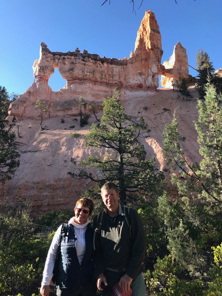

Then the landscape opened into vistas of pine trees and golden meadows and bison as if the Ponderosa ranch and Hoss and Little Joe magically appeared. We drove a further 2 hours to the Bryce Park entrance and our hotel adjacent, the Best Western Ruby’s Inn. The hotel reminded me of Gaitlinburg and every tourist trap rolled into one, but the rooms were clean and adequate and the proximity to the park was worth the sacrifice to the tour bus hordes. I did see a cowboy with spurs here so that’s something.


There’s a huge part of the southwest that was underwater several hundred million years ago (this is where volunteering at a natural history museum comes in handy). Multiple layers of sediment settled, the land rose up, some areas lifted more than others (by thousands of feet). The sediment hardened with other minerals being incorporated. Meanwhile freeze/thaw mechanical erosion and chemical erosion from rain caused certain areas to disappear, while a capstone of erosion resistant stone preserved other areas. Hoodoos are limestone and sandstone towers that have been saved from erosion (to date) by their capstone layer, although at lower levels erosion can cause instability and they will eventually fall. The red color is from iron in the sandstone. Oh, and I think I previously mentioned that cute red-headed TA in my college geology class. I did like that class…

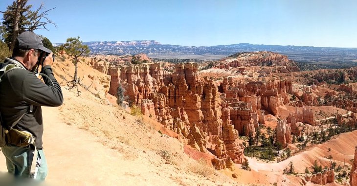
We then started hiking down amongst the hoodoos. We hiked parts of the Navajo and Queen’s Gardens trails, then caught Peekaboo trail over to Bryce Point Trail, an approximately 6 mi 1200ft elevation hike with some moderate ups and downs throughout. Around every corner was another ‘wow’ moment, another enchanting view of hoodoos and trees and color and beauty. The trail was quiet with few hikers although it seems there were a few unprepared people not unlike some we see attempting difficult climbs in the ADK. I lost my phone behind a tree (you can imagine) and Greg heroically hiked about a mile back to find it. We finished in about 3 hrs and shuttled back to Ruby’s for an Applebee’s type dinner, though Tina swears Applebee’s is better. She left on a quest for ice cream to end the day. Hiking reward!


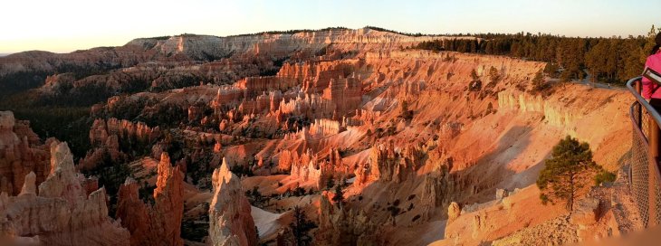
The next morning after competitive breakfasting at the buffet vs. other tourists, we skedaddled to the park to observe the sunrise over the canyon, 7:30am. There were more than a few photographers and wannabes set up alongside us. Although the sunrise and color change were quite nice it is hard to improve on the view.

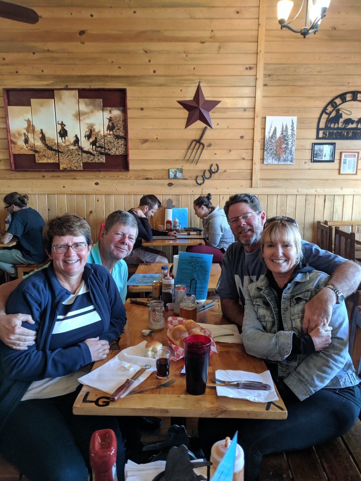
And it was only 30deg F. We then headed back down to the canyon floor for the 9 mi Fairyland Loop. We found the 4.5 hr hike beautiful but strenuous, with multiple ups and downs and 1800ft total elevation which felt like 18,000ft. We’d been hiking moderate to strenuous 5-9 mile hikes for each of 5 days. It’s time for a rest. As Bob says “I’m sick of hiking” (for today). After a drive to Rainbow Point at the end of the park through burned out forests and more canyon vistas, we cleaned up and drove to Panguitch for dinner. Tina’s father recommended the Cowboy Smokehouse which he had visited about 10 years before. Panguitch is a ‘one-horse’ town. The restaurant was quaint, the service was friendly and fun, the food (BBQ) was good though not the wine or the beer. Utah has a way to go in the alcohol quality department. Come on, Mormons, get with the program!!!
We headed to Moab the next morning via scenic routes 12 and 24. We stopped at a cool cafe, the Kiva Koffeehouse, just outside Escalante.
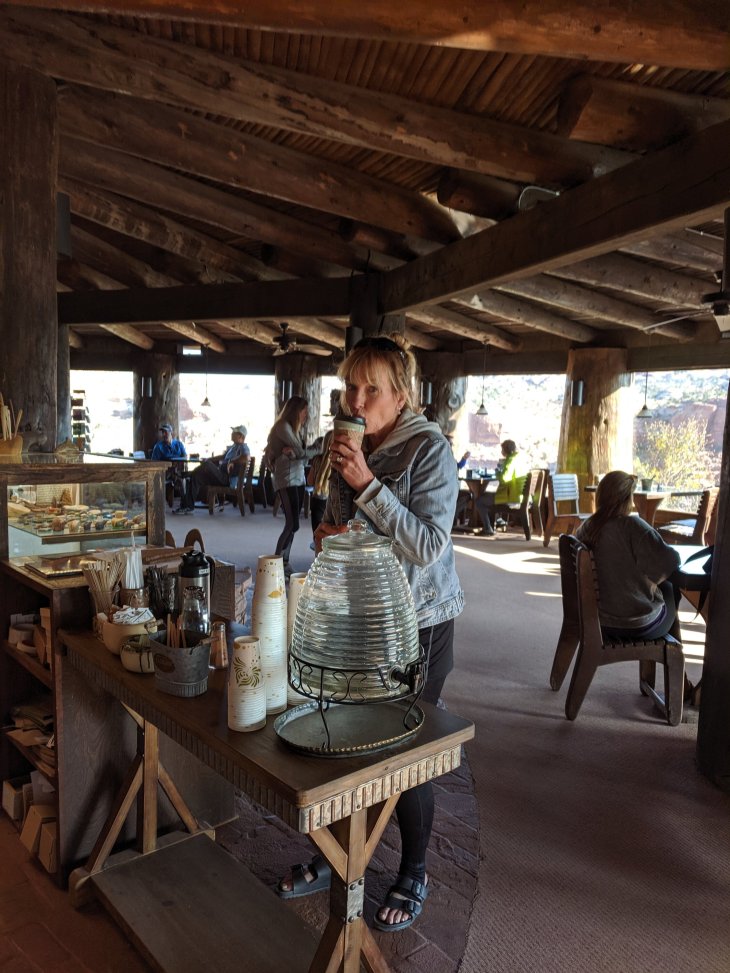
The coffeehouse is set into the side of one of the many cliffs along the many canyons and gorges we drove through.
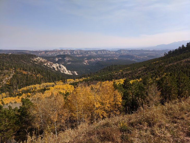
The drive was incredibly scenic and we stopped often. As we continued onto rt. 24 we crossed Boulder Mountain where the Aspen trees were turning vibrant yellow and contrasted against the dark green pines. Random free range cattle grazed road side.
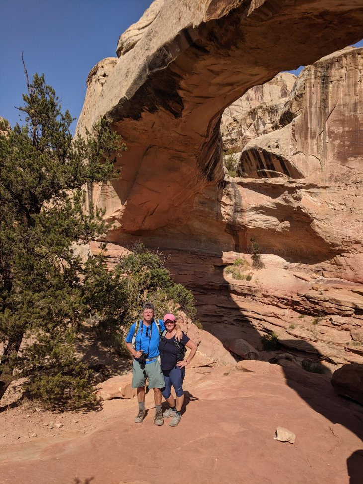
We stopped for Greg to photograph some more and then noticed smoke emanating from our rented Equinox. After determining it was transmission fluid hitting the hot engine, we continued on. We were in the middle of no where and I figured the 2 motorheads (Greg and Bob) knew what was what. It’s a sealed transmission and likely downshifting down the steep hills caused some pressure build up, so we shall see…We drove to and through Capitol Reef National Park, another amazing canyon of geological wonders. We opted for an easier hike, a 2 mi out and back trail to Hickman’s Bridge, a natural bridge formation. Again with the expansive views.

We drove on through the Hanksville area which soon became a landscape of towering grey shale and ‘cement’ piles for miles on end. It looked souless except for the ATV and motocross tracks everywhere. And then it became flat, sage covered desert for miles.
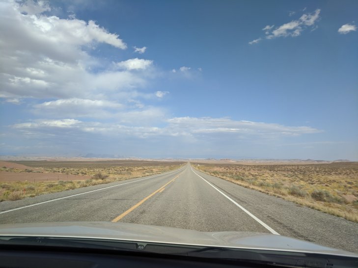
The changes we saw in landscape during the 4.5 hour drive were dramatic. We caught route 70 which had an 80mph speed limit and soon entered Moab where we will be hiking Arches and Canyonlands Parks for the next 2 days.
Visiting Bryce anytime soon? My recommendations:
Ruby’s Inn is adequate, clean, and convenient. There’s camping at Ruby’s or in the park. There are many amenities at both places. The Lodge inside the park is beautiful if you can reserve or afford. Other places look sketchy and are more distant. The shuttle runs frequently. Lots of bike trails throughout the park.
You don’t need to do the hikes to the bottom (7000ft to 8200ft) to enjoy the view. The rim views are spectacular. You can walk the rim trail to the north from Sunrise Point with moderate (300ft) elevation changes, 2.7 mi to the Fairyland parking lot. Remember you have to walk back, or just go part way. Definitely drive (or hike) to Bryce Point for viewing from the rim, maybe walk partway down to the arch. And go to Fairyland trailhead, maybe walk down a bit as well.
Rainbow Point is worth the drive but we felt the views were not the best.
Parking inside the park can be a problem so go early. The park is open 24/7 so if you go early or late, no fees! The shuttle runs from outside the park, just have your pass ready for the bus driver.
We had great weather, 30deg in the am, 70deg in the pm in October and sunny. We stayed 2 nights, 1.5 days of hiking, which was plenty of time. Be sure to have a panorama feature on your phone or camera. You’ll need it.
Bryce edges out Zion for best park so far.
Capitol Reef was also a nice park. The geology was different from Zion and Bryce. The Hickman’s Bridge hike was only 2 mi RT, but the path is uneven and with some sandy sections. Worth the effort though. There is a 10 mi scenic drive which we did not take.

great stuff, Bebers!
LikeLike
Love all the pics, stories, geology, and must do’s. Gotta go soon, thanks again Trail Blazers!
LikeLike